
Peel Ports to monitor Mersey Estuary from space
Port of Liverpool operator Peel Ports is to use satellites in space to ensure safety of ships navigating the River Mersey. Tony McDonough reports
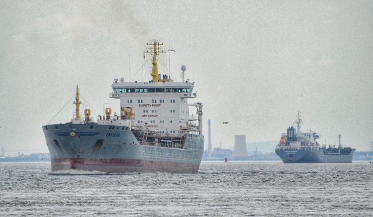
Peel Ports is to use satellites to create safer navigation channels at two of its biggest ports.
Partnering with the National Oceanography Centre (NOC) and Channel Coastal Observatory, the ports operator will use satellite technology to guide its dredging operations in the Mersey Estuary and Medway Estuary in Kent over a six-month period.
Funded by UK Space Agency Small Business Research, the NOC will use its patented coastal mapping technology to support the project.
Offering greater insight into changes to the marine environments around two of the UK’s most important waterways, Peel Ports will use the data to ensure safer access to the Port of Liverpool and Port of Medway for arriving ships.
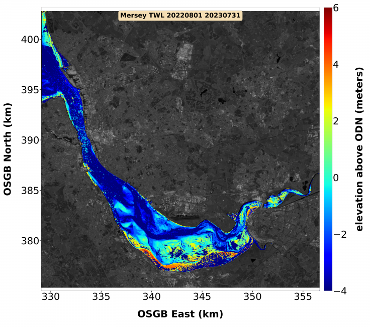
Traditionally, marine observation and maintenance is carried out using environmental surveys and annual dredging programmes, which come at high cost and provide limited data.
However, using the coastal mapping capabilities developed by the NOC’s Dr Paul Bell and Clive Neil, Peel Ports will be more informed with accessible data which maps marine features, including challenging intertidal areas that see the most changes.
As a result, Peel Ports will be able to identify issues and take action quicker and more effectively than before.
Gary Doyle, group harbour master at Peel Ports Group, said: “Like any statutory harbour authority, we have a duty to provide accurate and timely navigational information.
“Understanding the dynamics across our sites, and publishing accurate information, is vitally important to us and all those who rely on the waterways under our responsibility.
READ MORE: Peel Ports invites bids for £750m of works
READ MORE: Thousands on waterfront for Queen Anne ceremony
“We are constantly evaluating new technologies and this project will provide information on adding an additional flexible asset to our inventory. It will also allow us to assess what impact it will have in support of our marine decarbonisation plan.”
Christine Sams, head of research engagement at NOC added this collaboration is something that has never been done in the UK before.
“Not only will it give them a comprehensive overview of the Mersey and Medway estuaries, but it will also support Peel Ports to develop proactive dredging and maintenance strategies which will deliver a safer shipping environment for everyone,” she said.
Funding for the project came from its Unlocking Space for Business initiative, which offers applicants a share of £2m to combine terrestrial technologies with satellite data for transport, logistics, and financial services.