
Liverpool technology keeping infrastructure workers safe
Tech developed by Liverpool-based Mobile GIS Services is allowing critical road, water, gas and electricity workers to maintain their social distancing during the coronavirus epidemic. Tony McDonough reports
Liverpool tech firm Mobile GIS Services (MGISS) is helping engineers working on the UK’s critical infrastructure networks stay safe during the coronavirus epidemic.
While many business sectors either shut down or allowed people to work from home during the lockdown, people working on the highways and on water, gas and electricity networks continued to do essential work.
This week Transport Secretary Grant Shapps said a range of maintenance projects on the road and rail networks had been carried out during the lockdown and he unveiled a new £2bn package of spending to continue the upgrades.
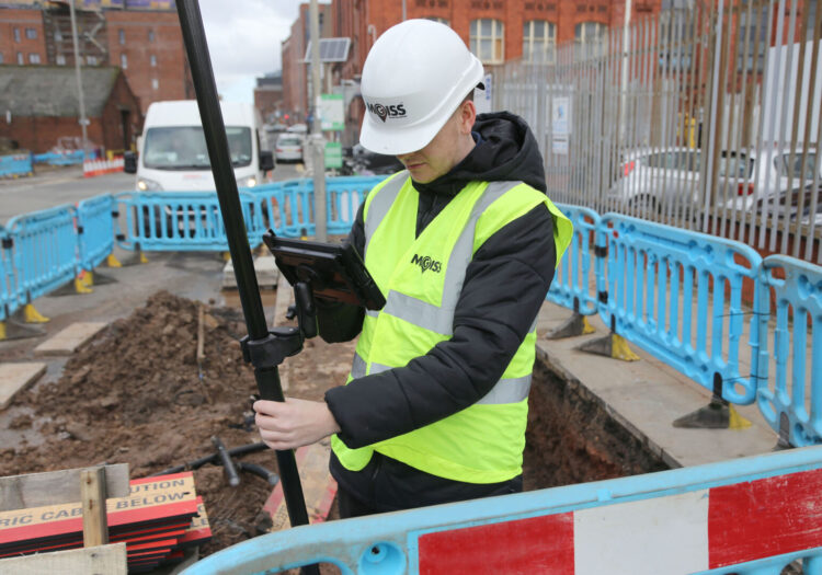
MGISS offers mobile apps using augmented reality technology that help improve field operations with intelligence on pipes and cables hidden underground.
Engineers responding to defects on the highway or problems in the supply of water, electricity and gas are improving their ability to locate and resolve defects and interruptions to supply quickly and efficiently using tools such as the Topografi web app.
Allowing for the simple, real-time capture and display of high-accuracy, 3D data compliant with local grids and models, Topografi is an end-to-end platform for capturing buried asset data and making it accessible and usable in the field.
Technologies such as satellite positioning systems and rugged field capture devices can ensure geographically accurate data can be captured efficiently, with confidence and in accordance with social distancing rules.
When combined with spatial data management technology from MGISS, such as the Topografi app, these technologies can ensure up to date information about essential infrastructure is available where and when it is needed to inform real time decision making and maximise resource deployment.
“Now, more than ever, it is essential that highway and utility infrastructure is well maintained and any issues are dealt with in a timely, effective, yet safe manner,” commented Mike Darracott, founder and managing director of MGISS.
“The geospatial community has a role to play supporting those workers that are still out there making sure our transport system continues to operate for essential journeys and there is continuity of service in the water, gas and electricity sectors.
“Easy access to usable, accurate and up to date information will help underpin the planning of routine works and the response to emergency call outs while, of course, observing safe working practices.”
MGISS is already supporting organisations such as the Northumbrian Water Group to improve the accuracy and currency of asset data and also worked alongside Highways England contractor Sir Robert McAlpine to implement a highway asset system.”